

Ryan Mieras Awarded $1M for Swash Zone Study
UNCW among top U.S. coastal universities studying how sand moves on nation’s beaches
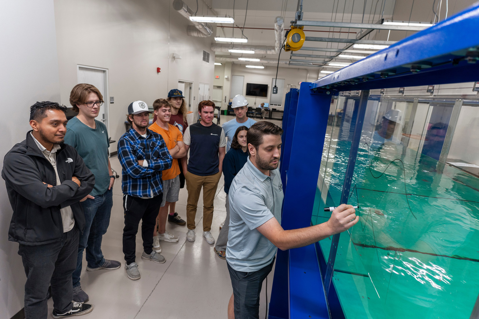
Photo: Michael Spencer/UNCW
Imagine standing at the shoreline on the beach, where breaking ocean waves rush in and out. Known as the swash zone, this area is where crucial sand movement occurs, shaping the nation’s coastlines over time.
To better understand how sand is transported in the swash zone, the U.S. Coastal Research Program (USCRP), via the U.S. Army Corps of Engineers (USACE), is funding a groundbreaking research project led by Dr. Ryan Mieras, UNCW assistant professor of coastal engineering. The nearly $1 million grant ($999,186) includes two collaborating institutions, University of Delaware and University of Texas at Austin.
Over the next four years, Mieras and co-investigators, Jack Puleo (UD), Blair Johnson (UT) and Tian-Jian Hsu (UD), and three doctoral students will aim to address critical gaps in computer models that forecast coastal change and flooding.
The collaborative study, slated for the summer of 2025, will be conducted at the USACE Engineering Research and Development Center (ERDC) Coastal and Hydraulics Laboratory (CHL) in Vicksburg, Mississippi. Mieras said the CHL wave flume, measuring 10 ft. wide and 200 ft. long, offers an ideal setting for controlled experiments that can quantify the physics of sand movement in the swash zone.
"In the field, it's challenging to control conditions, but in the lab, we can simulate different events and measure under repeatable conditions,” he said. “Our study aims to decipher how waves and extreme events cause sand movement, offering crucial information for weather services and the Army Corps of Engineers."
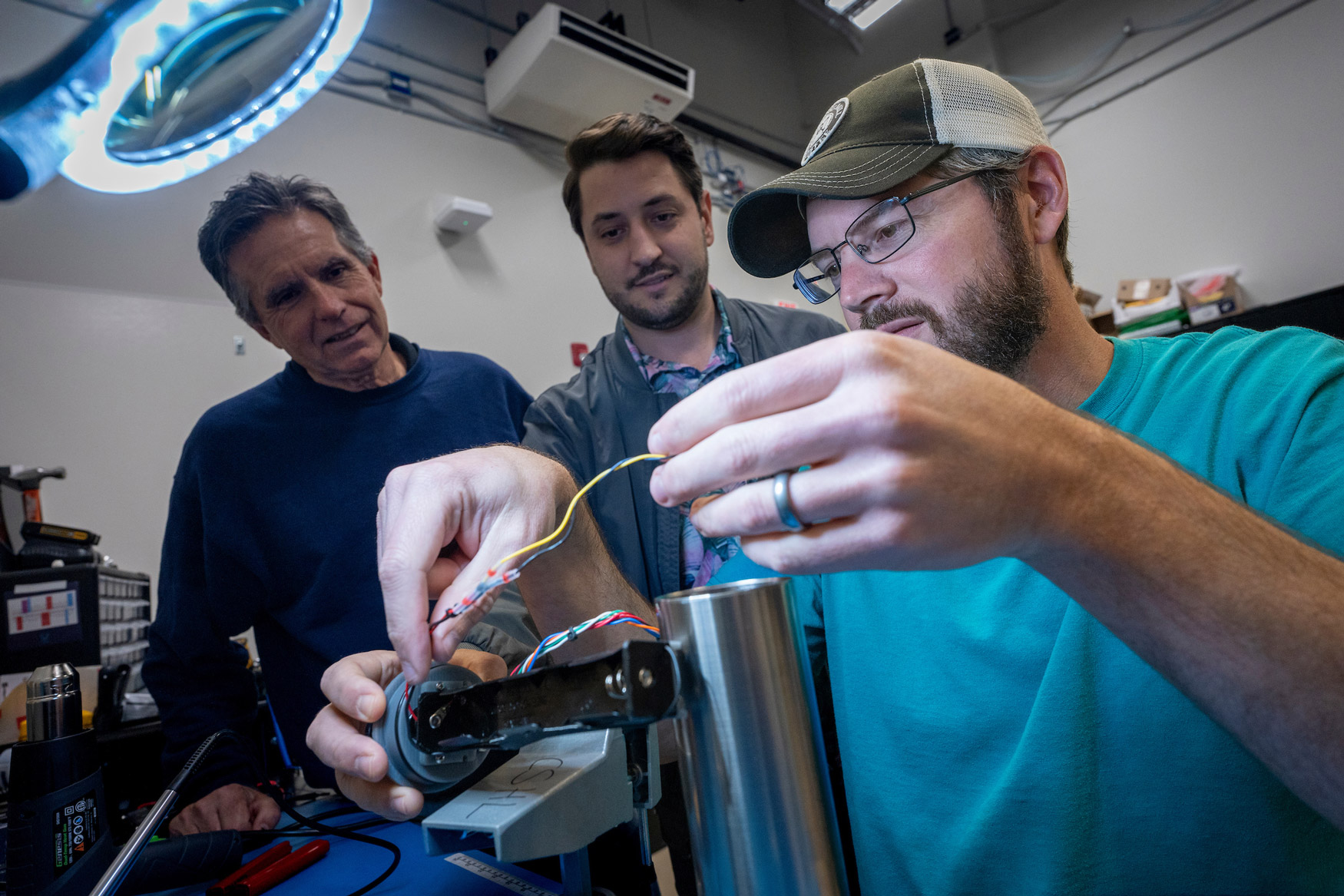
Photo: Jeff Janowski/UNCW
The research incorporates innovative technology, including LiDAR and sand transport sensors developed at UNCW through a separate $924,974 National Science Foundation grant awarded to Mieras in 2020. UNCW and collaborating university, University of Delaware, are the only universities in the world with the capability these instruments offer in measuring sand movement in the swash zone, according to Mieras, representing a significant advancement in coastal science instrumentation.
For the past year, Mieras’ undergraduate students have been manufacturing and testing the sensors and circuit boards in his Coastal Sediments and Hydrodynamics Lab and in the UNCW Coastal Engineering Wave Flume, recently commissioned in 2023.
The swash zone study anticipates outcomes that will contribute to improved weather predictions and beachfront property management. In four to five years, the research could revolutionize existing models, providing more accurate data that can aid communities in adapting to and mitigating the impacts of coastal changes.
"Our research will offer a better understanding of how small sand movements scale up over time, enabling communities to make informed decisions. By studying the swash zone, where over 50% of nearshore sand movement can occur, we contribute valuable data to the field of coastal science,” said Mieras.
This article has the following tags: CSE - College of Science & Engineering Research & Innovation myUNCW - Faculty & Staff